

The Geographical Information Systems (GIS) Laboratories of the Technology Center of the Academy of Sciences of Turkmenistan have developed a number of digital thematic maps using geographic information systems.
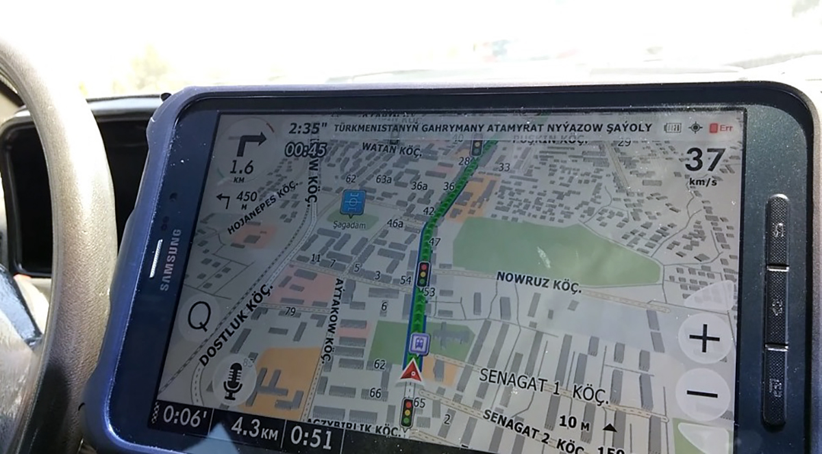
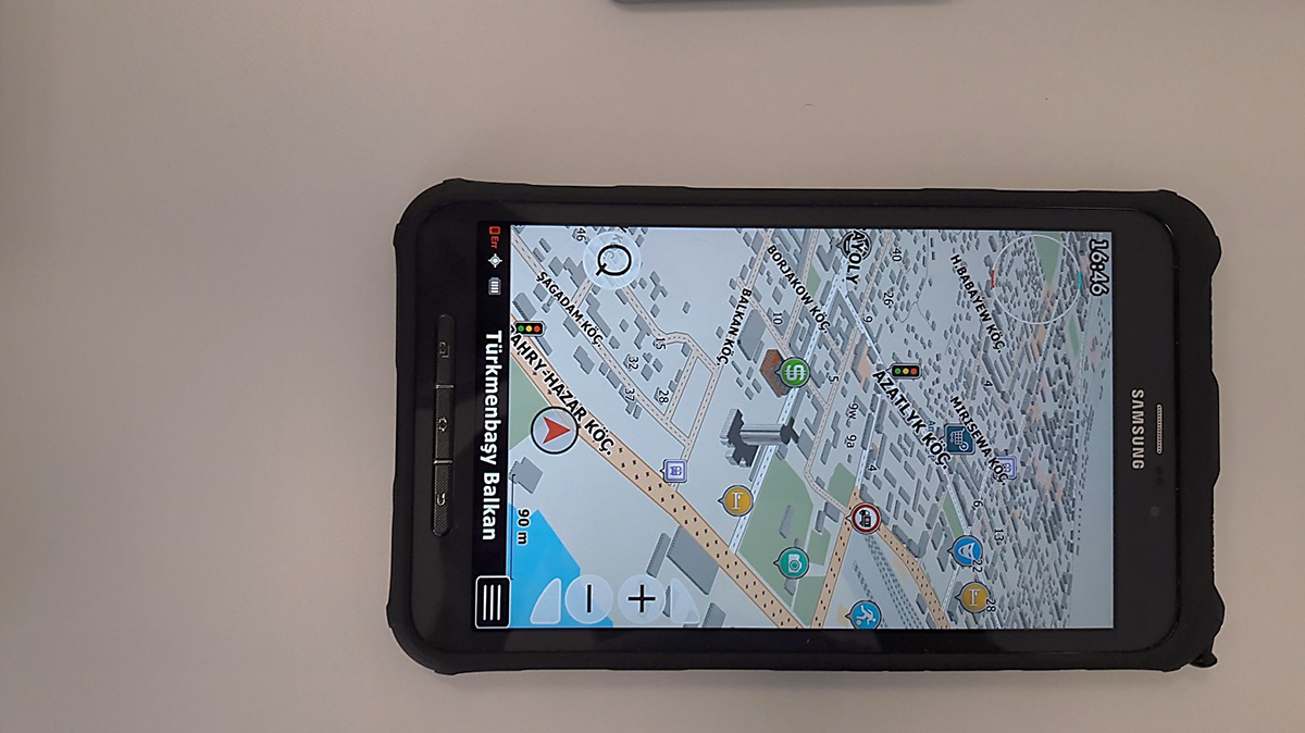
In particular, using modern digital technologies, databases and remote sensing, an automobile navigation map of the city of Turkmenbashi and the Avaza national tourist zone was created. Approbation of a modern digital map was successfully carried out on the Garmin auto-navigation system, as well as on mobile devices (smartphone and tablet).
The task of creating a map was solved by the laboratory researchers using the methodology of cartographic support for auto-navigation systems, in relation to the territory of Turkmenistan. This technique includes a sequence of operations for the collection and processing of primary data, constant updating of video recording data (which provides for regular updating of key objects of the map content, infrastructure and points of interest).
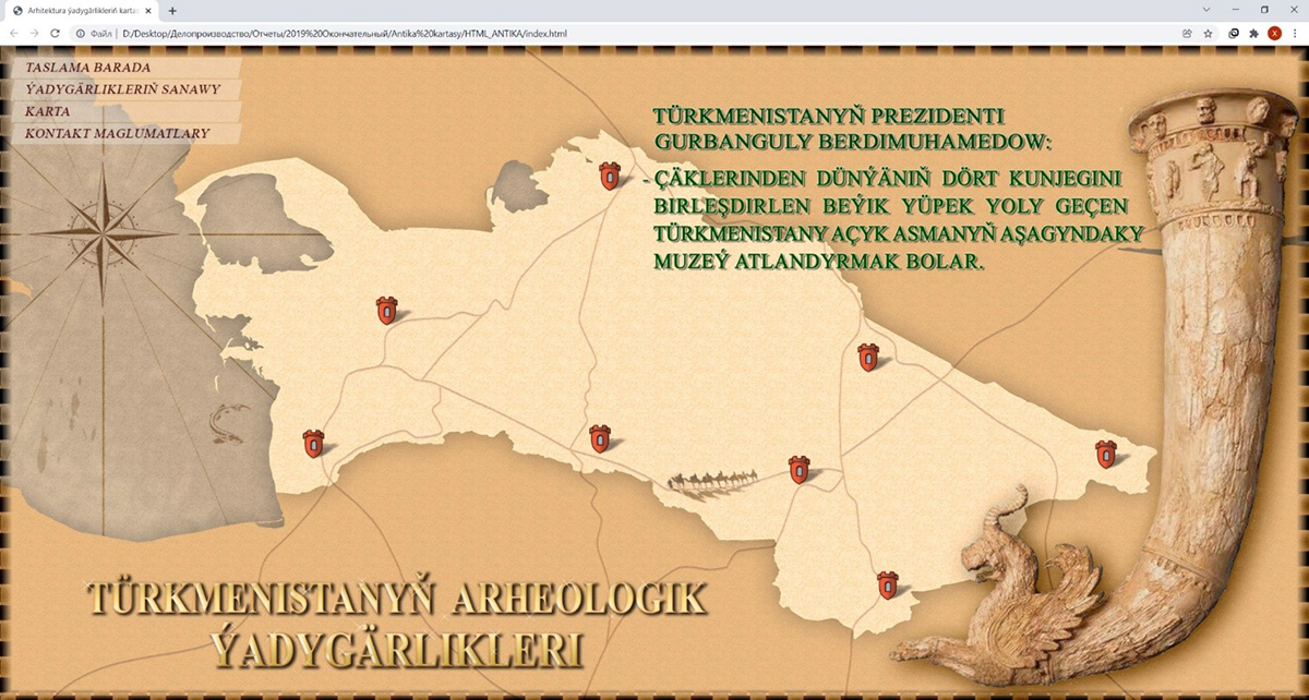
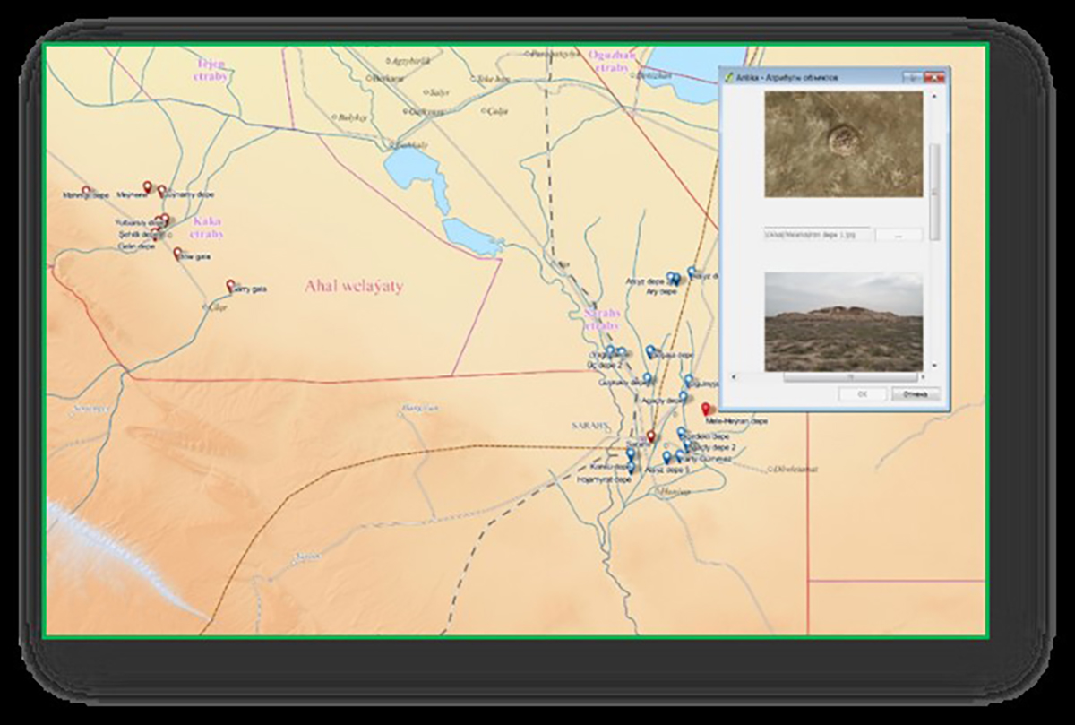
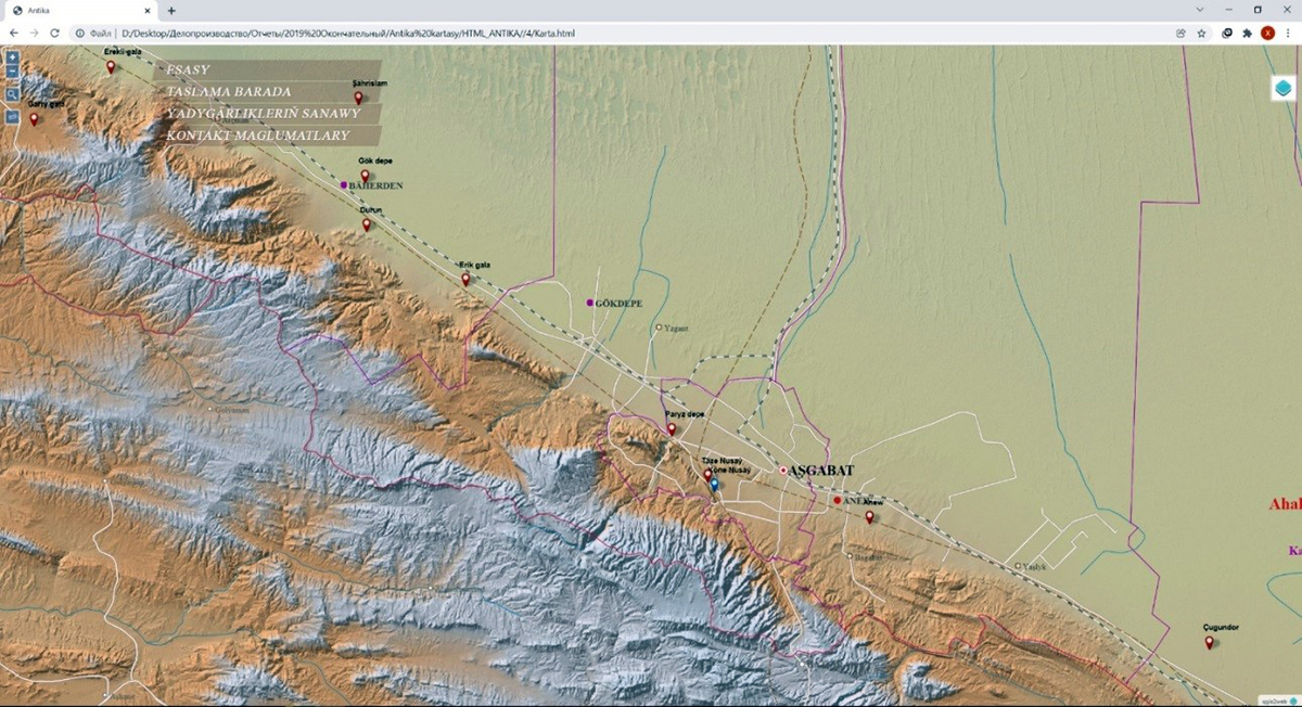
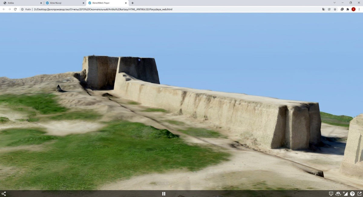
In addition, these techniques were used in the development of an interactive map of the archaeological sites of Turkmenistan. This map tells about the monuments of the Middle Ages and the ancient period. It is presented in the form of Internet pages containing information about the map, a list and textual description of archaeological sites, the interactive map itself and contact information.
The digital interactive map provides attributive information - indicates the names of the monument, velayat, etrap in which the monument is located, time of existence, distance and direction to the nearest settlement, settlements of Turkmenistan and border states, water bodies (rivers, lakes), roads, railways roads, route of the Great Silk Road, background with relief and background with space images.
Generalization functions have been added to the map when zooming in / out, functions for moving around the map, switching layers and searching for objects by name. Individual monuments have 3d models that open in separate tabs via links.
Pasture vegetation maps were prepared in the area of Altyn Asyr Lake and the Krasnovodsk Plateau using GIS technologies, as well as during multi-level monitoring of vegetation and soil in this area and on the Caspian lowland. During the creation of vegetation maps, modern GIS and remote sensing technologies were used. In the work, the normalized differentiated vegetation index (NDVI) was used in relation to satellite images for April-May.
NDVI uses the characteristic features of the reflection of vegetation in the red and near infrared range of the spectrum and allows you to study the state of the vegetation cover. The values of this index were classified according to the volume of biomass, making it possible to determine the forage capacity of pastures. As a result, the area of each category and the number of small ruminants that can be placed on it were determined. This makes it possible to quickly monitor pasture vegetation and plan the distribution of livestock on pastures throughout the year.
Now the laboratory staff is conducting a number of scientific and self-supporting topics related to cartographic support for a comprehensive assessment of the agrochemical state of irrigated lands and the organization of multifunctional monitoring of the country's pasture lands.
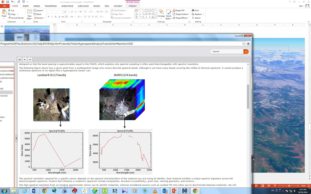
The methodology includes the use of remote sensing data and parallel land-based field studies of vegetation and soil.
With the help of a high-precision field spectroradiometer, spectral characteristics were studied and spectral libraries of vegetation and soil were compiled in the region of the Altyn Asyr Turkmen Lake and the Caspian lowland. The resulting spectral libraries make it possible to identify the types of soils and vegetation.
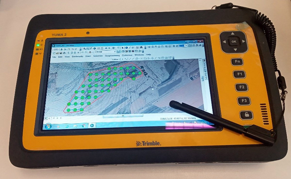
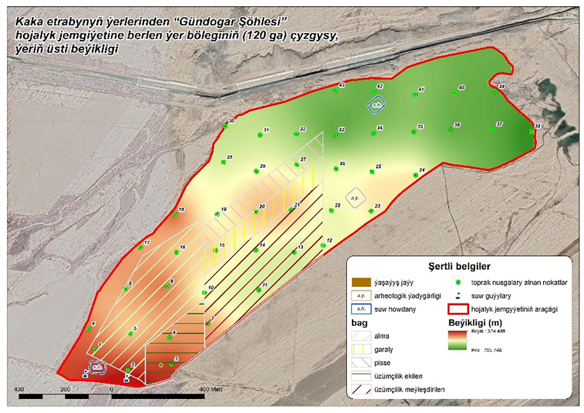
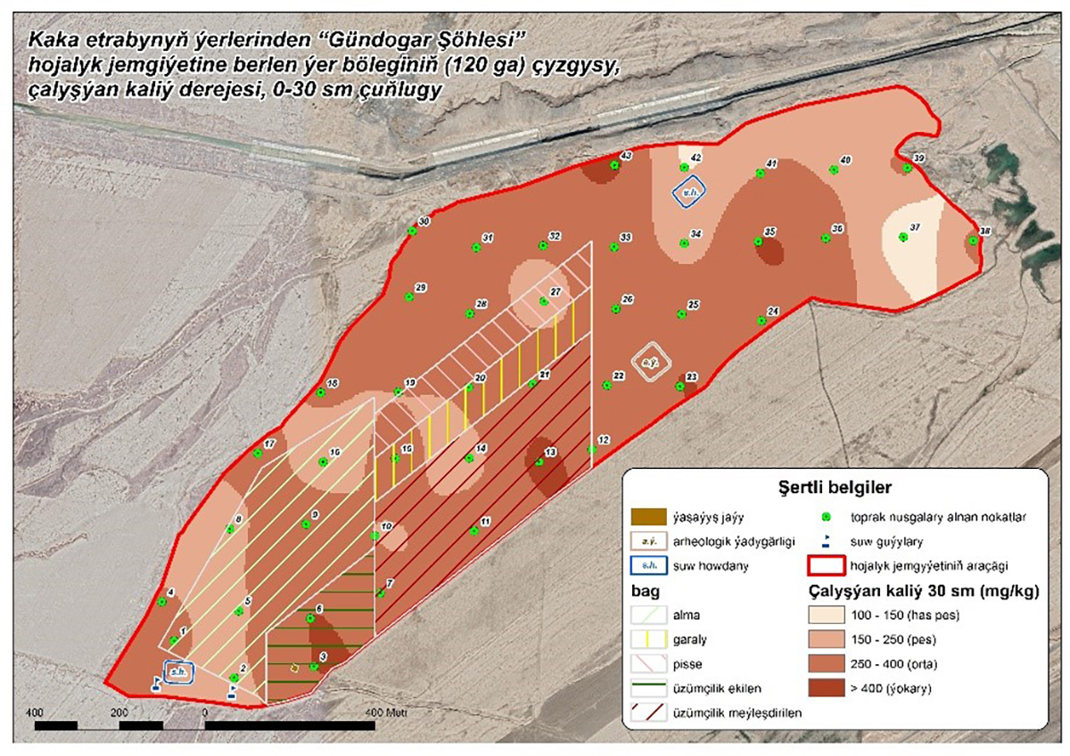
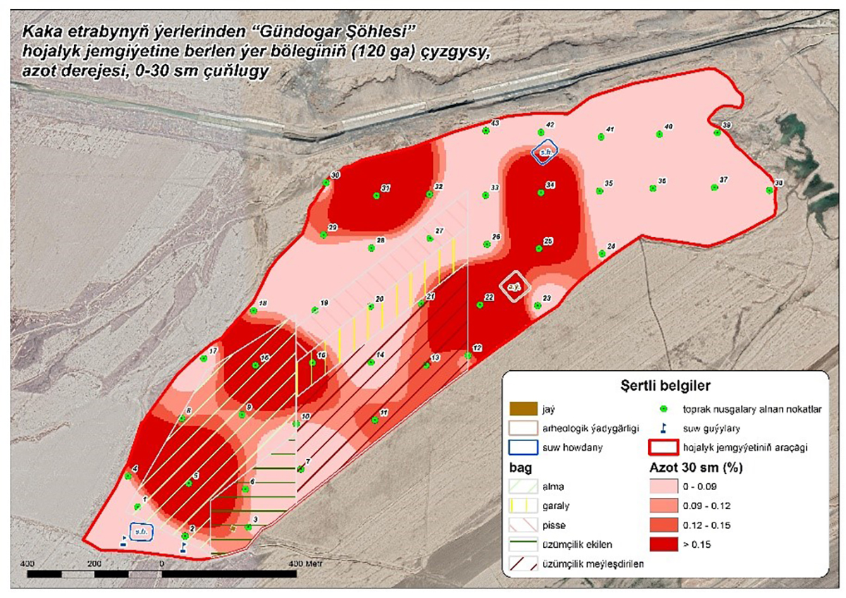
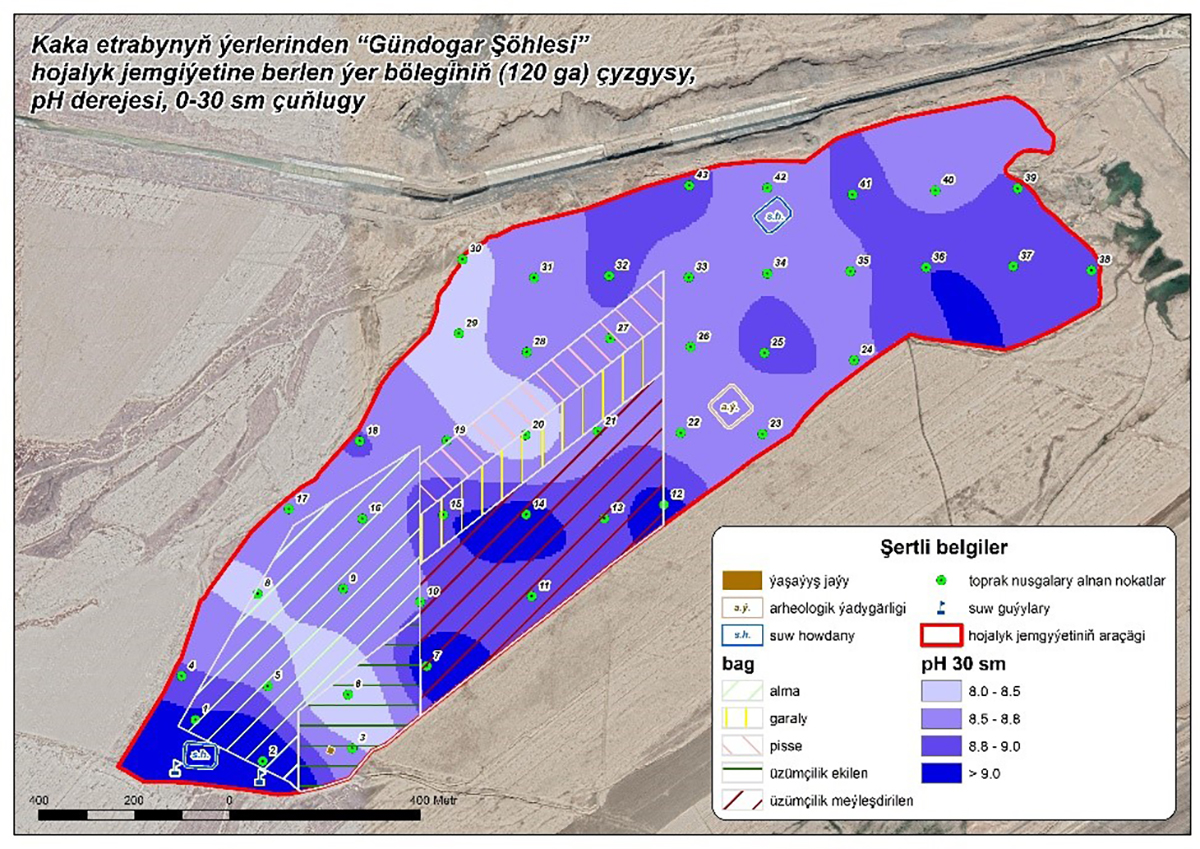
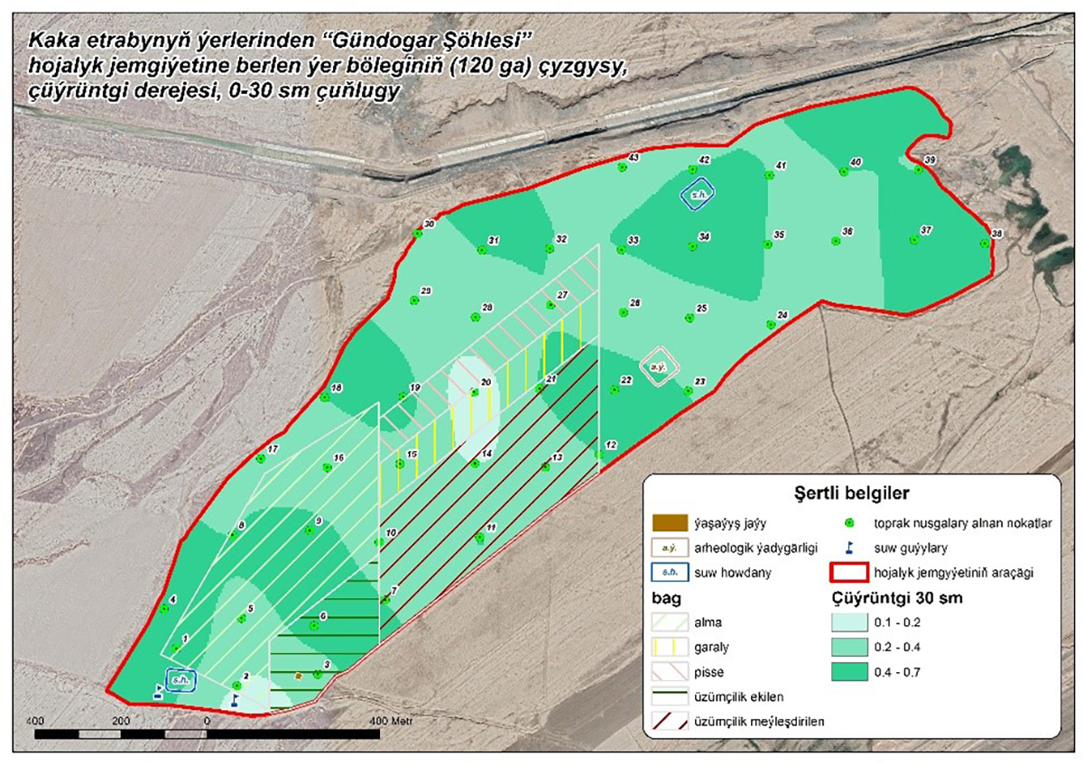
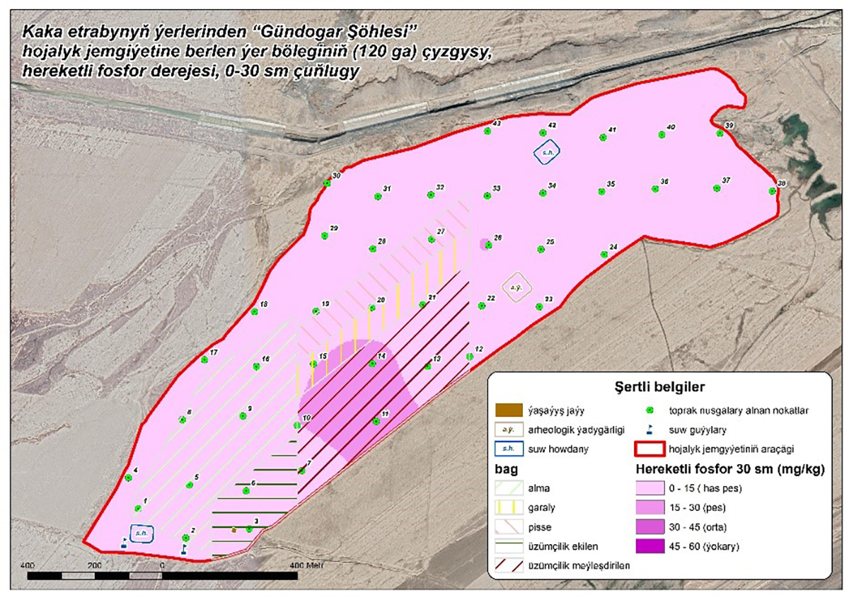
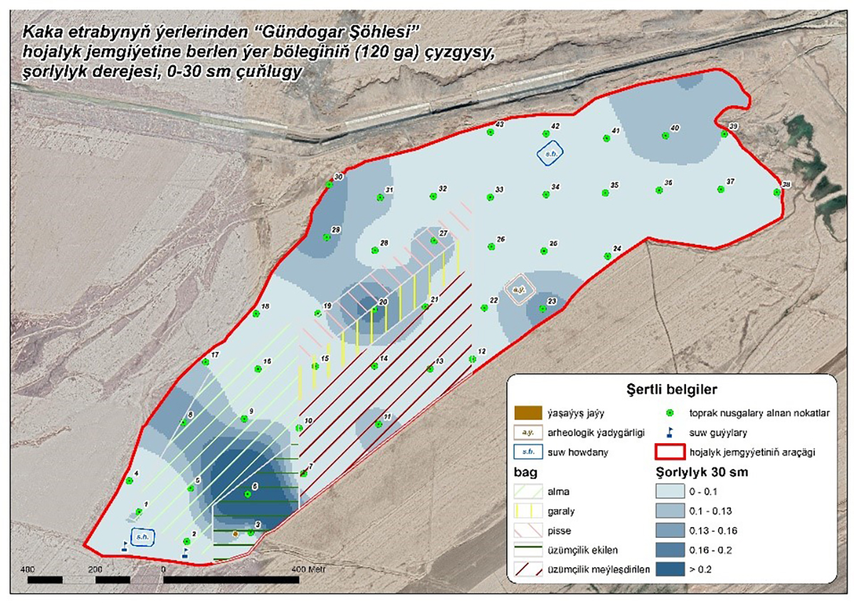
Analysis of the actual state of irrigated lands of agricultural enterprises with the preparation of cartograms for the presence of chemical macro and microelements in the soil.
This work was carried out on the example of the land plot of the economic company "Gündogar Şöhlesi". Based on the selected soil and water samples, an agrochemical survey was carried out, and the results were entered into the database of the ArcGis program, where, using the interpolation method, cartograms were created for the presence of macro and microelements necessary for good growth of crops and perennial plantations on the site. This method of creating cartograms will help the land user to dose organic and mineral fertilizers, taking into account the plasticity of the relief, to carry out the most rational watering of the land plot, to apply agro-reclamation measures in saline areas.